E. Atmospheric Structure in Equilibrium States |
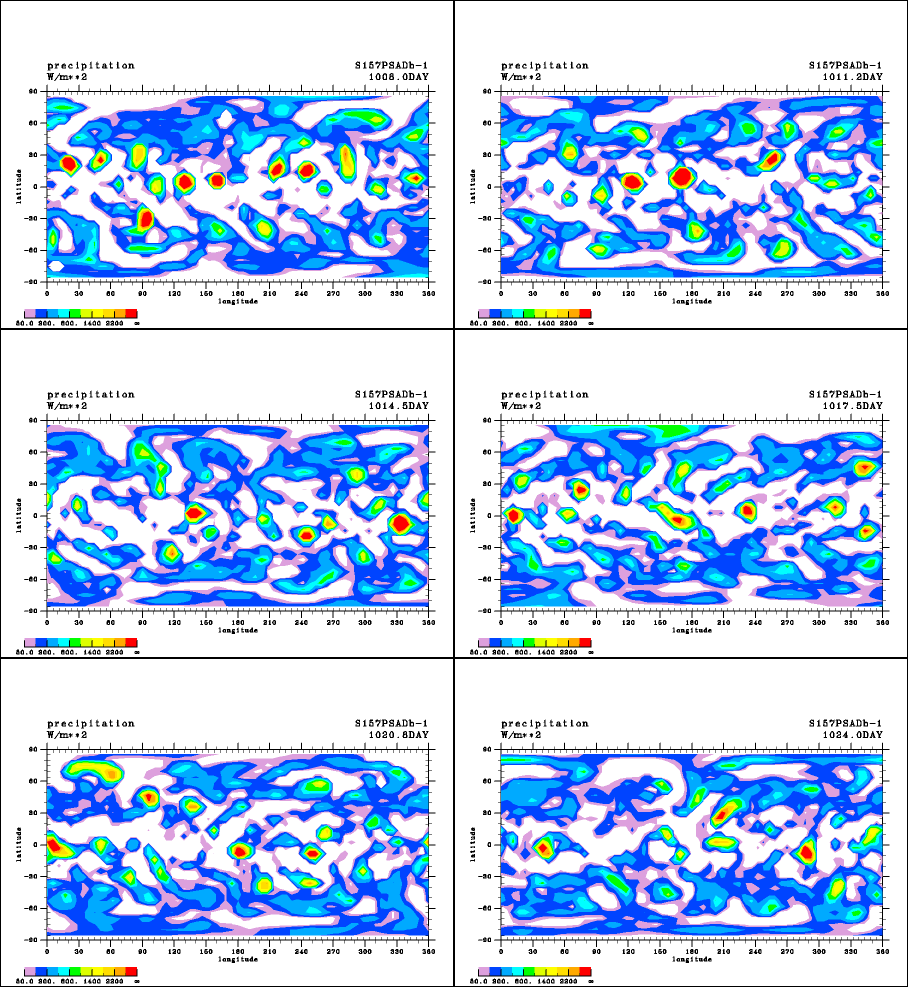
Time Evolution of the Precipitation Distribution in Experiment S1570
In Experiment S1570, vortex disturbances originating in the equatorial region and migrating to the mid-latitudes are the most active around 40° latitude north and south. For example, the disturbance that is present near 15° latitude, 220° longitude on Day 1008 migrates to 25° latitude, 260° longitude on Day 1012 and then to 40° latitude, 315° longitude on Day 1016. After this day, the disturbance migrates to higher latitudes and then eastward nearly along 60° latitude north and disappears on Day 1026. Most precipitation near 40° latitude north and south is caused by this type of disturbance. Although not shown in the form of a figure, a vortex structure characterizes these disturbances and typhoons on the actual Earth would be the closest equivalent of these disturbances. An examination of high latitude regions poleward of latitude 60° shows a broad precipitation band as wide as 100 longitudinal degrees. This precipitation band moves eastward and persists for 10 to 20 days. Although the precipitation band presumably forms as a result of baroclinic instabilities, it cannot be concluded with certainty since no analysis has yet been conducted on the circulation structure.

Animation 1: Time evolution of the precipitation distribution (W/m2) in Experiment S1570. The animation illustrates the time evolution for a 16-day period in conditions that are considered to be nearly in equilibrium.